
Kedarkantha Trek
Uttarakhand
Duration
5D/4N
Grade
Easy - Moderate
Max Altitude
12,500ft.
Trekking Km
20 Kms
Valley of Flowers Trek Overview
- Trek Name: Kedarkantha Trek
- Location: Uttarakhand, India
- Days: 6 Days / 5 Nights
- Pickup & Drop: Rishikesh
- Base Camp: Govindghat
- Adventure: Trekking
- Maximum Altitude: 14,100 ft (4,300 m) (Hemkund Sahib)
- Trek Distance: 38 km
- Difficulty Level: Easy to Moderate
- Season: Monsoon
- Months: July | August | September
The Kedarkantha Trek is one of the most popular and scenic winter treks in Uttarakhand, known for its snow-covered trails, dense pine forests, and stunning Himalayan summit views. Located in the Govind Pashu Vihar National Park in the Garhwal region of Uttarakhand, the trek takes you through charming villages, frozen lakes, and peaceful alpine meadows before reaching the Kedarkantha summit. From the top, trekkers are rewarded with breathtaking 360-degree views of majestic peaks such as Swargarohini, Bandarpoonch, and Black Peak.
Ideal for beginners as well as experienced trekkers, the Kedarkantha Trek offers a perfect introduction to winter trekking in the Himalayas. The journey is especially famous for its beautiful campsites like Juda Ka Talab and the magical experience of trekking through fresh snow. Best experienced between December and April, the trek provides an unforgettable adventure filled with snow trekking, clear night skies, and mesmerizing sunrise views from the summit, making it one of the best winter trekking experiences in India.
Kedarkantha Trek Itinerary
Day 1 – Drive From Dehradun to Sankri
• Altitude: Dehradun (640 m / 2,100 ft), Sankri (1,950 m / 6,400 ft)
• Altitude Gain: 1,310 m / 4,300 ft
• Drive Distance: 190 km | 8–9 hrs
• Begin your journey with a scenic drive through Mussoorie, Purola, and Mori, passing dense forests, river valleys, and charming Himalayan villages before reaching Sankri, the base village of the Kedarkantha Trek.
Day 2 – Trek From Sankri to Juda Ka Talab
• Altitude: Sankri (1,950 m / 6,400 ft), Juda Ka Talab (2,700 m / 8,900 ft)
• Altitude Gain: 750 m / 2,500 ft
• Trek Distance: 4–5 km | 4–5 hrs
• Start your trek through dense pine forests and wooden bridges, gradually ascending to the beautiful frozen lake of Juda Ka Talab, a peaceful campsite surrounded by snow (in winter).
Day 3 – Trek From Juda Ka Talab to Kedarkantha Base Camp
• Altitude: Juda Ka Talab (2,700 m / 8,900 ft), Kedarkantha Base Camp (3,400 m / 11,250 ft)
• Altitude Gain: 700 m / 2,350 ft
• Trek Distance: 3–4 km | 3–4 hrs
• Continue trekking through oak and pine forests with panoramic mountain views, reaching the scenic base camp of Kedarkantha, offering clear views of surrounding Himalayan peaks.
Day 4 – Summit Kedarkantha Peak and Descend to Hargaon Camp
• Altitude: Base Camp (3,400 m / 11,250 ft), Kedarkantha Peak (3,800 m / 12,500 ft), Hargaon (2,600 m / 8,500 ft)
• Altitude Gain: 400 m / 1,250 ft (summit), then descent
• Trek Distance: 6–7 km | 7–8 hrs
• Begin an early morning summit climb to witness a breathtaking sunrise over Swargarohini, Bandarpoonch, and Black Peak. After spending time at the summit, descend to Hargaon camp through snow-covered trails.
Day 5 – Trek From Hargaon to Sankri and Drive to Dehradun
• Altitude: Hargaon (2,600 m / 8,500 ft), Sankri (1,950 m / 6,400 ft), Dehradun (640 m / 2,100 ft)
• Altitude Loss: 1,960 m / 6,400 ft
• Trek Distance: 6 km | 3–4 hrs
• Drive Distance: 190 km | 8–9 hrs
• Descend back to Sankri through forest trails, followed by a scenic drive back to Dehradun, marking the end of the Kedarkantha Trek adventure.
Day 1 – Drive From Dehradun to Sankri
- Altitude: Dehradun (640 m / 2,100 ft) → Sankri (1,950 m / 6,400 ft)
- Altitude Gain: ~1,310 m / 4,300 ft
- Drive Distance: ~190 km | 8–10 hr
Your Kedarkantha Trek starts from Dehradun, gradually leaving the city behind as the road climbs into the Shivalik foothills. The drive is long but extremely scenic, transitioning from urban traffic to winding mountain roads bordered by forests, rivers, and small Himalayan settlements.
The route follows the Tons River valley, passing through Purola and Mori, where the lifestyle becomes distinctly mountain-based with wooden homes, terraced fields, and small roadside markets. As you go deeper, the landscape becomes more dramatic with dense pine and deodar forests, narrow bridges, and deep valleys.
A key section of the journey passes through Govind Pashu Vihar National Park, a protected wildlife region known for its rich Himalayan biodiversity. You may also catch distant views of snow peaks depending on the season and weather.
The final stretch to Sankri is narrow and winding, running alongside the Supin River and dense forest cover. On arrival, the small village of Sankri appears nestled among mountains, serving as the base for the Kedarkantha Trek.
By evening, reach Sankri, check into your stay, and rest in the peaceful Himalayan environment before the trek begins.
Highlights of the Day:
• Drive from Dehradun into the Garhwal Himalayas
• Scenic Tons River valley route
• Purola and Mori mountain towns
• Forest drive through Govind Pashu Vihar region
• Supin River views and Himalayan landscapes
• Arrival at Sankri base village
Meals Included: Dinner
Stay: Guesthouse / Homestay in Sankri
Day 2 – Sankri to Juda Ka Talab
- Altitude: Sankri (1,950 m / 6,400 ft) → Juda Ka Talab (2,700 m / 8,900 ft
- Altitude Gain: ~750 m / 2,500 ft
- Trek Distance: ~4 km | 3–4 hr
Day 2 of the Kedarkantha Trek begins from the peaceful village of Sankri after breakfast. The trail gradually ascends, leaving behind the last signs of habitation as you enter dense alpine forests. The path is well-defined but steadily uphill, giving your body time to acclimatize to the increasing altitude.
The route initially passes through small wooden houses and terraced clearings before quickly transitioning into thick forests of pine, oak, and maple. As you gain height, the forest becomes quieter and more immersive, with sunlight filtering through tall trees and the sound of distant streams accompanying you along the way.
Midway, the terrain becomes more gradual in sections, allowing for short breaks and panoramic glimpses of surrounding valleys and distant snow-clad peaks (season dependent). In winter, this stretch is often blanketed in snow, turning the forest trail into a white corridor.
As you approach Juda Ka Talab, the landscape opens into a serene high-altitude meadow. The frozen or semi-frozen lake (depending on the season) is surrounded by dense trees, creating one of the most picturesque camping spots on the entire Kedarkantha route. This campsite is especially magical in winter when the lake is completely frozen and the surrounding forest is covered in snow.
By afternoon or early evening, reach Juda Ka Talab, settle into your campsite, and enjoy the calm of the Himalayan wilderness under a vast open sky filled with stars at night.
Highlights of the Day:
• Gradual ascent from Sankri into alpine forests
• Dense pine, oak, and maple forest trails
• First major campsite at Juda Ka Talab
• Scenic clearings and mountain valley views
• Frozen lake (seasonal highlight in winter)
• Peaceful high-altitude camping experience
Meals Included: Breakfast, Lunch, Dinner
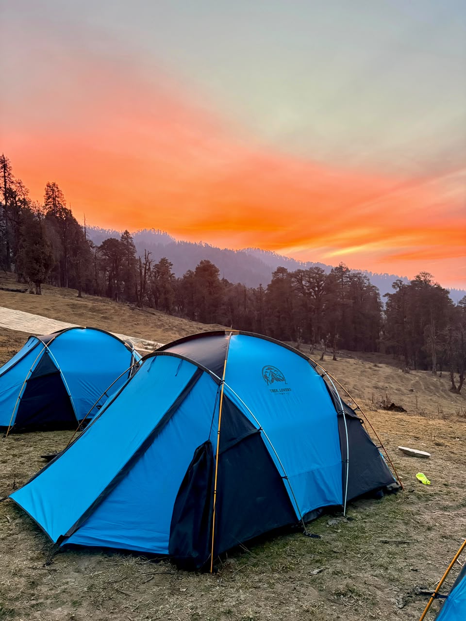
Stay: Alpine Tent Camping at Juda Ka Talab
Day 3 – Juda Ka Talab to Kedarkantha Base Camp
- Altitude: Juda Ka Talab (2,700 m / 8,900 ft) → Kedarkantha Base Camp (3,400 m / 11,250 ft)
- Altitude Gain: ~700 m / 2,300 ft
- Trek Distance: ~4 km | 3–5 hr
Day 3 of the Kedarkantha Trek begins with a cold mountain morning at Juda Ka Talab. After breakfast, the trail continues deeper into the alpine zone, where the forest gradually thins and the landscape starts opening up into wide meadows and snow-covered clearings (especially in winter).
The initial ascent is moderately steep as you leave the lake behind and enter a dense stretch of pine and oak forest. This section is known for its peaceful atmosphere, where the only sounds are crunching footsteps (or snow under boots in winter) and occasional bird calls. As you climb higher, the tree line begins to fade, and expansive Himalayan views start appearing between clearings.
Midway through the trek, the terrain transitions into open alpine slopes. On clear days, you can see prominent Himalayan peaks such as Swargarohini, Bandarpoonch, and Ranglana ranges standing tall in the distance. The air becomes noticeably colder and crisper as you gain altitude.
The final stretch to Kedarkantha Base Camp is a gradual ascent across vast snowy meadows. The campsite sits in an open valley surrounded by towering peaks and forest ridges, offering one of the most dramatic camping settings of the entire trek. In winter, this entire area transforms into a white bowl of snow, making it a perfect pre-summit resting point.
By afternoon, reach Kedarkantha Base Camp, settle into your tents, and prepare for the early summit push the next day. The evening is usually spent enjoying sunset views over the Himalayas and the silent beauty of high-altitude wilderness.
Highlights of the Day:
• Ascent from Juda Ka Talab into alpine meadows
• Gradual transition from forest to open snowfields
• First clear views of major Himalayan peaks
• Scenic ridge and valley landscapes
• Arrival at Kedarkantha Base Camp
• Stunning sunset views in high Himalayas
Meals Included: Breakfast, Lunch, Dinner
Stay: Alpine Tent Camping at Kedarkantha Base Camp
Day 4 – Base Camp to Kedarkantha Summit to Juda Ka Talab
- Altitude: Kedarkantha Base Camp (3,400 m / 11,250 ft) → Kedarkantha Summit (3,800 m / 12,500 ft) → Juda Ka Talab (2,700 m / 8,900 ft)
- Altitude Gain: ~400 m / 1,300 ft (to summit), followed by descent of ~1,100 m / 3,600 ft
- Trek Distance: ~5 km | 5–7 hr
Day 4 of the Kedarkantha Trek begins in the early hours of the morning, usually around 2:00–3:00 AM. The summit push starts under a sky full of stars, with headlamps lighting the snowy trail. This is the most challenging and rewarding section of the trek.
The climb from Kedarkantha Base Camp is initially steep, moving through snow-covered slopes and ridgelines. As you ascend higher, the forest disappears completely and the trail becomes fully exposed, offering glimpses of distant snow peaks even before sunrise.
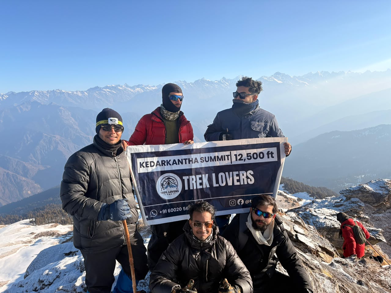
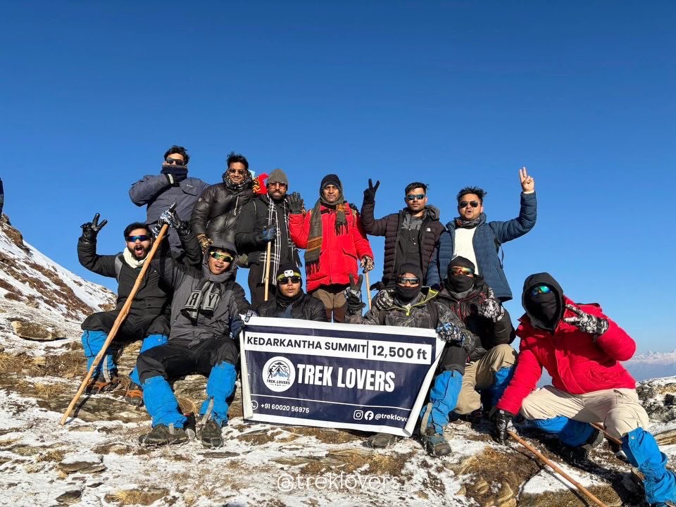
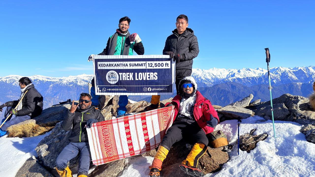
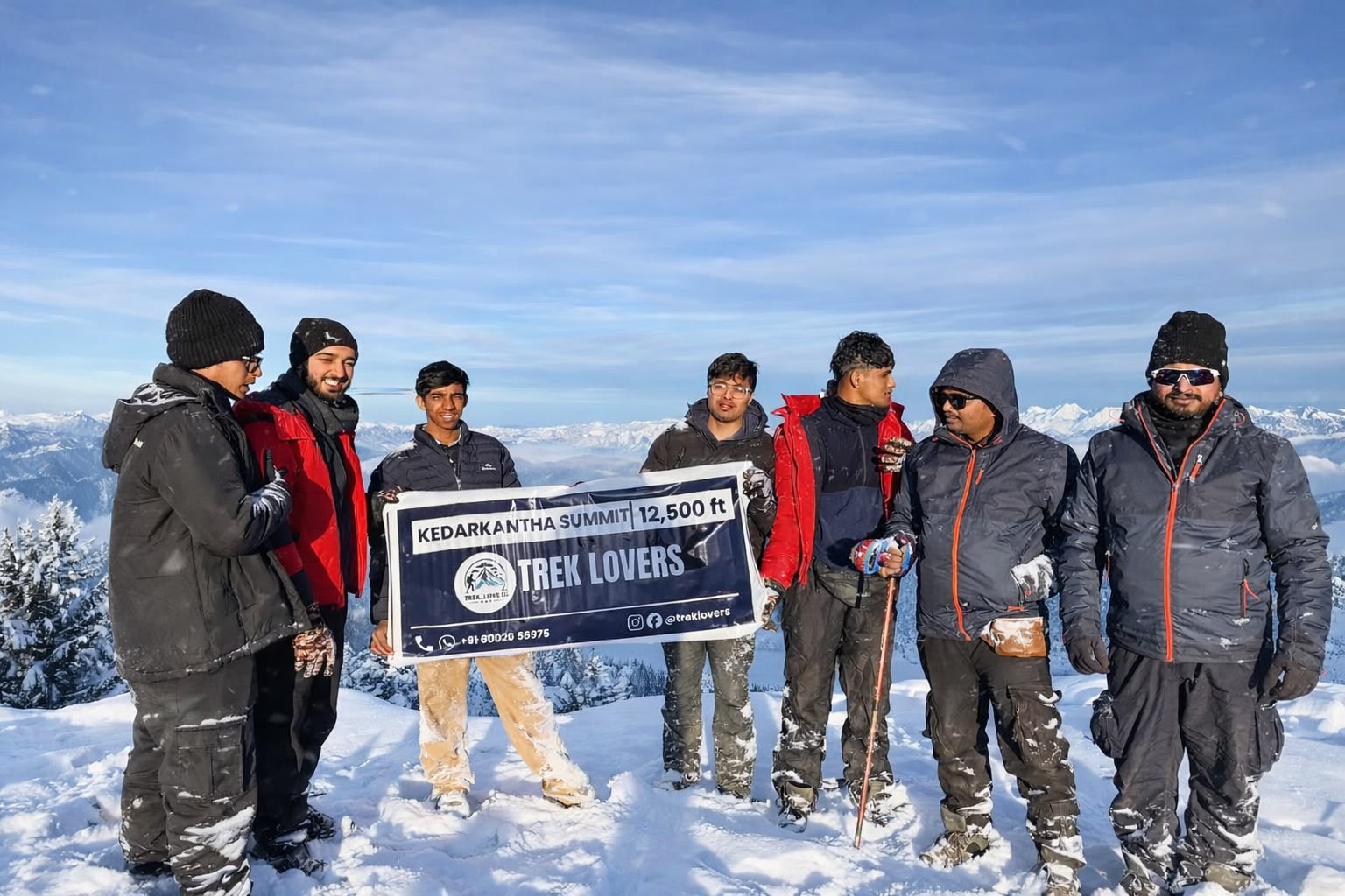
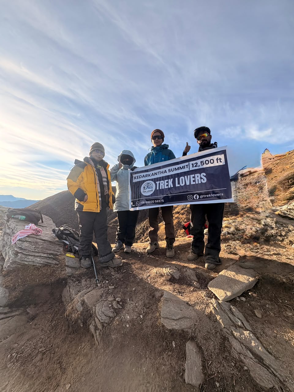
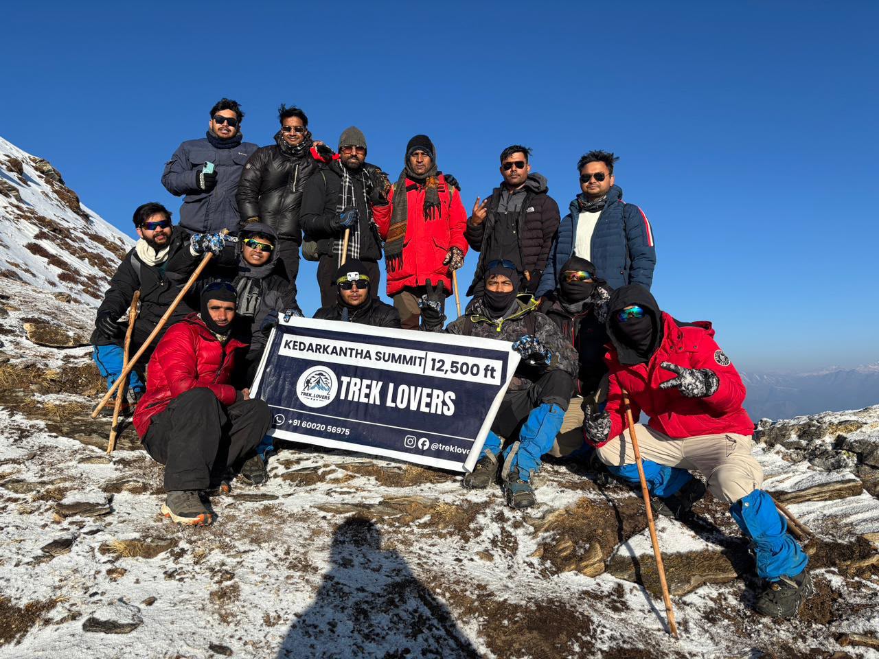
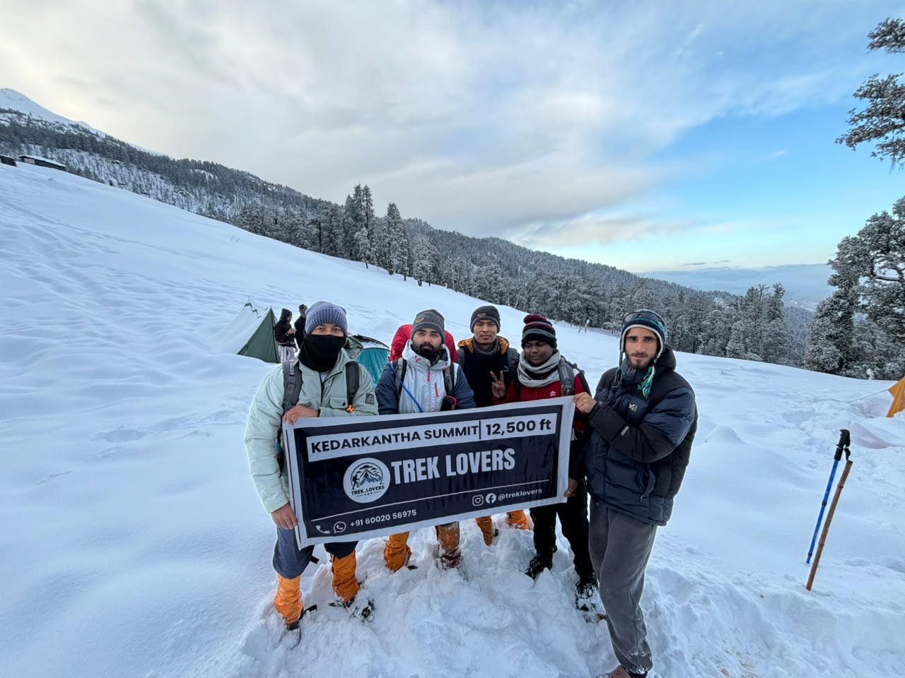
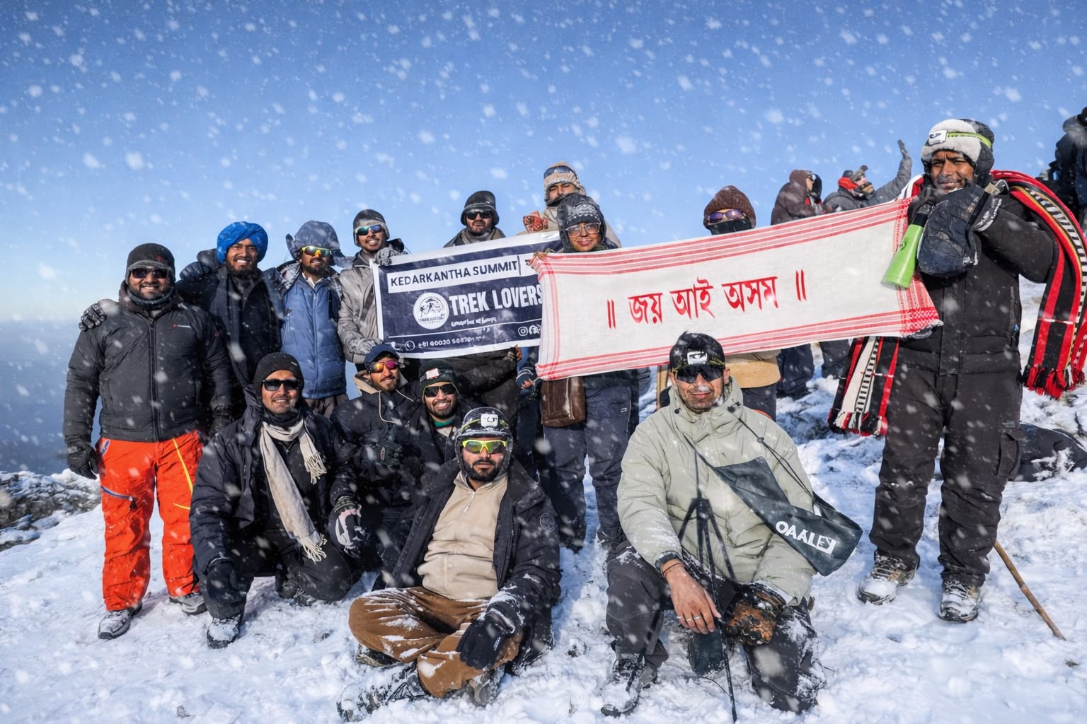
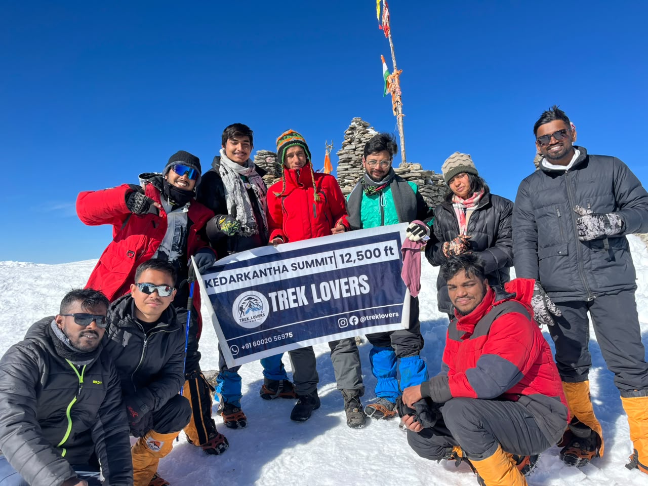
The final ridge walk to the Kedarkantha Summit is both thrilling and demanding, with sharp ascents and cold winds at high altitude. Once at the top, you are rewarded with a breathtaking sunrise over Himalayan giants like Swargarohini, Bandarpoonch, Black Peak, and the Gangotri ranges. The 360-degree panoramic view from the summit is the highlight of the entire trek.
After spending time at the summit for rest and photography, you begin the descent back towards Kedarkantha Base Camp. The trail retraces the same snowy ridges and alpine slopes, gradually becoming easier as you lose altitude.
From Base Camp, the descent continues further down through forest trails and open clearings, eventually reaching Juda Ka Talab. This stretch brings you back into dense pine and oak forests, where the snow-softened ground and peaceful surroundings offer a contrasting calm after the summit excitement.
By afternoon or evening, reach Juda Ka Talab, where you rest for the night surrounded by alpine forest silence.
Highlights of the Day:
• Early morning summit push under starlit skies
• Challenging ridge ascent to Kedarkantha Peak
• Spectacular sunrise over Himalayan ranges
• 360° panoramic views from the summit
• Long descent through alpine slopes and forests
• Return to serene campsite at Juda Ka Talab
Meals Included: Breakfast, Lunch, Dinner
Stay: Alpine Tent Camping at Juda Ka Talab
Day 5 – Juda Ka Talab to Sankri to Dehradun
- Altitude: Juda Ka Talab (2,700 m / 8,900 ft) → Sankri (1,950 m / 6,400 ft) → Dehradun (640 m / 2,100 ft)
- Altitude Loss: ~2,060 m / 6,800 ft (total descent)
- Trek Distance: ~4 km trek + ~190 km drive | 8–10 hr
Day 5 marks the final leg of the Kedarkantha Trek, beginning with a short descent from Juda Ka Talab to Sankri after breakfast. The trail winds down through dense pine, oak, and maple forests, gradually transitioning from quiet alpine wilderness back toward the inhabited mountain village. This stretch is relatively easy compared to the summit day, allowing you to enjoy the last views of the forested Himalayas at a relaxed pace.
Upon reaching Sankri, you freshen up briefly and begin the long drive back to Dehradun. The journey retraces the scenic route through the Supin and Tons River valleys, passing through small mountain settlements, terraced fields, and dense forest sections inside the Govind Pashu Vihar region. The changing landscape slowly shifts from remote Himalayan terrain to bustling foothill roads.
The drive is long but scenic, offering one final look at the Garhwal Himalayas as you descend completely into the plains. By evening, you arrive in Dehradun, marking the end of your Kedarkantha Trek adventure.
Highlights of the Day:
• Descent from Juda Ka Talab to Sankri through alpine forest
• Final views of Kedarkantha trekking region
• Scenic drive along Supin & Tons river valleys
• Pass through Govind Pashu Vihar National Park region
• Transition from mountains to plains
• Return to Dehradun
Meals Included: Breakfast
Stay: Not included (trek ends in Dehradun)
Kedarkantha Trek Cost Terms – Inclusions & Exclusions
• Accommodation in guest houses/homestays at Sankri on Day 1 and Day 5 (or equivalent stay in Dehradun on return), and alpine tented camps during the trek (Juda Ka Talab and Kedarkantha Base Camp).
• All meals during the trek (usually from Day 1 dinner to Day 5 breakfast).
• Certified trek leader, local guides, cooks, and support staff.
• Camping equipment such as tents, sleeping bags, sleeping mats, dining tents, and toilet tents (where camping is applicable).
• Transportation between Dehradun and Sankri (Dehradun–Sankri–Dehradun transfers).
• Forest permits, entry fees, and necessary trekking permissions.
• Basic safety equipment including first-aid kits, oxygen cylinders, oximeters, and emergency support.
• Group safety equipment such as ropes and other technical gear if required depending on conditions.
• Assistance during acclimatization and trek coordination throughout the journey.
• Personal expenses such as snacks, mineral water, beverages, laundry, and phone calls
• Porter or mule charges for personal luggage (available at extra cost)
• Backpack offloading charges (if not included in package)
• Personal trekking gear such as shoes, jackets, thermals, gloves, and backpacks
• Emergency evacuation or medical expenses beyond basic first aid support
• Tips for trek staff (guides, porters, cooks, etc.)
• Any additional accommodation or transport costs due to weather delays or early exit
• Meals during transit (Dehradun to Sankri and return journey meals not included)
• Anything not specifically mentioned in the inclusions list
Kedarkantha Trek Essentials – Complete Packing List
- 2–3 quick-dry T-shirts (preferably full-sleeve)
- 2 trekking pants (avoid jeans)
- 1 fleece jacket
- 1 down/padded jacket
- 1 thermal set (top and bottom)
- Waterproof rain jacket or poncho
- 4–5 pairs of socks (mix of woolen and synthetic)
- Warm cap/beanie and sun cap
- Waterproof gloves + fleece/wool gloves
- Buff or neck gaiter
- Waterproof trekking shoes with good grip and ankle support
- Sandals/Crocs for campsite and river crossings
- Extra pair of comfortable camp footwear
- 50–60 L backpack with rain cover
- 15–20 L daypack (if using porter/offloading service)
- Trekking pole(s)
- Headlamp with spare batteries
- Dry bags or zip-lock bags for clothes/electronics
- Water bottles (2 L total capacity) or hydration bladder
- Power bank
- UV-protection sunglasses
- Sunscreen SPF 50+
- Lip balm
- Hand sanitizer
- Wet wipes/toilet paper
- Toothbrush and basic toiletries
- Personal medicines and first-aid items
- ORS packets and energy bars/dry fruits
- Government photo ID
How To Reach Valley of Kedarkantha Trek
The nearest airport is Jolly Grant Airport, Dehradun (DED)
• Distance from airport to Rishikesh: ~20–25 km | 45 minutes
• Regular flights operate from Delhi, Mumbai, Bangalore, and other major cities
• From airport, taxis and cabs are easily available to Dehradun
• Nearest railway stations: Dehradun railway station, Rishikesh Railway Station and Haridwar Junction
• Dehradun is better connected with major Indian cities
• From Haridwar to Rishikesh: ~25 km | 45–60 minutes by road
• Trains available from Delhi, Kolkata, Mumbai, Lucknow, and more
• Dehradun is well connected via National Highways
• Delhi to Dehradun : ~240 km | 6–7 hours
• Regular Volvo buses, government buses, and private taxis are available from ISBT Kashmiri Gate (Delhi)
• You can also drive or hire a private cab directly to Dehradun
Kedarkantha Trek FAQ's
What is the Kedarkantha Trek famous for?
The Kedarkantha Trek is famous for its panoramic Himalayan views, beginner-friendly trail, and beautiful snow-covered landscapes in winter. It is one of the most popular winter treks in India.
Where is the Kedarkantha Trek located?
The Kedarkantha Trek is located in the Govind Wildlife Sanctuary in Uttarakhand. The trek typically starts from the village of Sankri.
What is the best time to do the Kedarkantha Trek?
The best time for the Kedarkantha Trek is from December to April for snow trekking and from March to June for pleasant weather and clear mountain views. Winter is especially popular because of the snow-covered trails.
Is the Kedarkantha Trek suitable for beginners?
Yes, the Kedarkantha Trek is considered one of the best beginner-friendly Himalayan treks. It requires moderate fitness and does not involve technical climbing.
How difficult is the Kedarkantha Trek?
The trek is generally rated as easy to moderate. Trekkers walk for about 4 to 7 hours each day, with gradual ascents that are manageable for most healthy individuals.
What is the total distance of the Kedarkantha Trek?
The total trekking distance is approximately 20 to 24 kilometers round trip, depending on the route and campsite locations.
How long does the Kedarkantha Trek take?
Most Kedarkantha Trek itineraries take 4 to 6 days, including travel between Dehradun and Sankri.
What is the maximum altitude of the Kedarkantha Trek?
The highest point of the trek is the Kedarkantha Summit, which stands at approximately 12,500 feet (3,800 meters) above sea level.
What should I pack for the Kedarkantha Trek?
You should pack warm layered clothing, waterproof trekking shoes, gloves, woolen caps, thermal wear, a backpack, a water bottle, sunscreen, a headlamp, and basic medicines.
Is the Kedarkantha Trek safe?
Yes, the Kedarkantha Trek is generally safe for trekkers when undertaken with experienced guides or reputable trekking operators. Following safety guidelines and monitoring weather conditions are important, especially during winter.
₹7,499/-
₹5,499/-
Per Person
- Services Dehradun to Dehradun | Included Transport
- Complimentary cloakroom at base camp for safe storage.
- Pickup Location: Prince Chowk, Dehradun
- Drop Location: Prince Chowk, Dehradun
- Pickup: 9:00 AM | Drop: 5:00–6:30 PM (traffic/river activity dependent)
- Keep a buffer day and arrive a day early to avoid delays due to traffic, weather, or local conditions.
- Booking Policy
- Cancellation Policy
- Terms & Conditions
Get in Touch with Our Trek Expert
Connect Now
- +91-6002056975
- +91-9395931311
- treklovers11@gmail.com
- Monday–Saturday: 10 AM to 06 PM (GMT +5:30)